Ficheiro:Australia first map.jpg

Dimensões desta antevisão: 800 × 598 píxeis. Outras resoluções: 320 × 239 píxeis | 640 × 479 píxeis | 1 024 × 766 píxeis | 1 280 × 958 píxeis | 2 560 × 1 915 píxeis | 3 604 × 2 696 píxeis.
Imagem numa resolução maior (3 604 × 2 696 píxeis, tamanho: 3,81 MB, tipo MIME: image/jpeg)
Histórico do ficheiro
Clique uma data e hora para ver o ficheiro tal como ele se encontrava nessa altura.
| Data e hora | Miniatura | Dimensões | Utilizador | Comentário | |
|---|---|---|---|---|---|
| atual | 00h58min de 17 de outubro de 2006 |  | 3 604 × 2 696 (3,81 MB) | Gobeirne | |
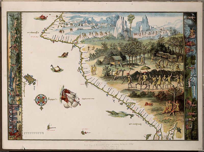
| 22h55min de 30 de novembro de 2005 |  | 760 × 580 (110 kB) | Matilda | First map of Australia [cartographic material] : from Nicholas Vallard's atlas, 1547, in the Library of Sir Thomas Phillipps, Bart. at Middle Hill, 1856. Image from the National Library of Australia: http://nla.gov.au/nla.map-rm2393 From NLA catalogure i |
Utilização local do ficheiro
As seguintes 13 páginas usam este ficheiro:
- Austrália Branca
- Colônia da Tasmânia
- Colônia de Nova Gales do Sul
- Colônia de Queensland
- Descoberta da Austrália
- Eureka Stockade
- Federalismo na Austrália
- Federação da Austrália
- João Alfonso
- Mapas de Dieppe
- Ordem da Austrália
- Teoria da descoberta da Austrália pelos portugueses
- Predefinição:Esboço-históriaau
Utilização global do ficheiro
As seguintes wikis usam este ficheiro:
- af.wiki.x.io
- en.wiki.x.io
- es.wiki.x.io
- fr.wiki.x.io
- he.wiki.x.io
- id.wiki.x.io
- it.wiki.x.io
- ja.wiki.x.io
- jv.wiki.x.io
- ka.wiki.x.io
- mk.wiki.x.io
- nl.wiki.x.io
- ru.wiki.x.io
- ru.wikiversity.org
- sr.wiki.x.io
- tr.wiki.x.io
- uk.wiki.x.io