Ficheiro:Congo Rep Dem carte.gif
Sem resolução maior disponível.
Congo_Rep_Dem_carte.gif (330 × 355 píxeis, tamanho: 18 kB, tipo MIME: image/gif)
|
|
Esta imagem provém do Wikimedia Commons, um acervo de conteúdo livre da Wikimedia Foundation que pode ser utilizado por outros projetos.
|
Descrição do ficheiro
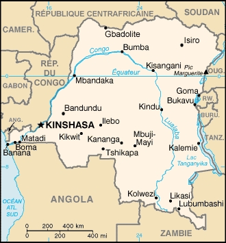
| Descrição | French map of the Democratic Republic of the Congo |
| Data | of this version : June 2006 |
| Origem | CIA World Factbook |
| Autor | of the translation : Eric Gaba (Sting) |
| Permissão (Reutilizar este ficheiro) |
PD |
| Outras versões | original English version : Image:Cg-map.png |
Français : * Sujet : Carte en français de la République Démocratique du Congo ;
- Source : CIA World Factbook ;
- Autre version disponible : anglophone : Image:Cg-map.png
- Auteur de la traduction : Eric Gaba (fr:Sting) ;
- Date : Juin 2006.
Licenciamento
Esta imagem se encontra no domínio público, já que seu conteúdo provém de CIA World Factbook, um trabalho da Agência Central de Inteligência dos Estados Unidos da América.
|
 |
| This work was previously under Public Domain, or a Free License. It has been digitally enhanced and/or modified. This derivative work has been (or is hereby) released into the public domain by its author, Sting at the French Wikipedia project. This applies worldwide. In some countries this is not legally possible; if so:
|
Histórico do ficheiro
Clique uma data e hora para ver o ficheiro tal como ele se encontrava nessa altura.
| Data e hora | Miniatura | Dimensões | Utilizador | Comentário | |
|---|---|---|---|---|---|
| atual | 01h13min de 16 de junho de 2006 | | 330 × 355 (18 kB) | Sting | "Gbadolite" : more important city |
| 17h57min de 15 de junho de 2006 |  | 330 × 355 (18 kB) | Sting | {{Information |Description=French map of the Democratic Republic of the Congo |Source=[http://www.cia.gov/cia/publications/factbook/ CIA World Factbook] |Date=of this version : June 2006 |Author=of the translation : Eric Gaba (Sting) |Permi |
Utilização local do ficheiro
A seguinte página usa este ficheiro:
Utilização global do ficheiro
As seguintes wikis usam este ficheiro:
- an.wiki.x.io
- bs.wiki.x.io
- el.wiki.x.io
- en.wiki.x.io
- eo.wiki.x.io
- es.wiki.x.io
- fa.wiki.x.io
- fr.wiki.x.io
- République démocratique du Congo
- Congo (fleuve)
- Pool Malebo
- Lac Tanganyika
- Rusizi
- Lukuga
- Mpozo (rivière)
- Lomami (rivière)
- Lac Mai-Ndombe
- Kasaï (rivière)
- Barrages d'Inga
- Uele (rivière)
- Oubangui
- Lukaya (rivière)
- Lulonga
- Sankuru (rivière)
- Lac Moero
- Chambeshi
- Chutes Livingstone
- Chutes Boyoma
- Malagarasi
- Luvwa
- Chutes de la Lofoyi
- Dja
- Utilisateur:Nécropotame/Feuille de route
- Communauté économique des pays des Grands Lacs
- Lac Delcommune
- Lac Upemba
- Barrage Inga I
- Barrage Inga II
- Barrage Grand Inga
- Mobutisme
- Itimbiri (rivière)
- Mongala (rivière)
- Gombe (rivière)
- Tshopo (rivière)
Ver mais utilizações globais deste ficheiro.