Ficheiro:Dem congo sat.jpg

Dimensões desta antevisão: 608 × 600 píxeis. Outras resoluções: 243 × 240 píxeis | 487 × 480 píxeis | 779 × 768 píxeis | 1 038 × 1 024 píxeis | 2 293 × 2 261 píxeis.
Imagem numa resolução maior (2 293 × 2 261 píxeis, tamanho: 3,13 MB, tipo MIME: image/jpeg)
|
|
Esta imagem provém do Wikimedia Commons, um acervo de conteúdo livre da Wikimedia Foundation que pode ser utilizado por outros projetos.
|
Descrição do ficheiro
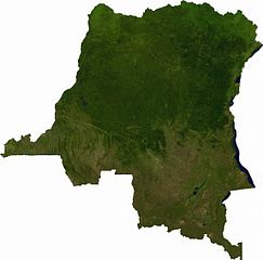
Raster data download July 12, 2006 from The Map Library: exported to TIFF format, and converted to JPEG via Paint.NET.
Licenciamento
| This file is in the public domain, because it was generated by a user, using free sources available at The Map Library.
Note that this does not include the maps in the Global Administrative Areas section of the homepage. |
Histórico do ficheiro
Clique uma data e hora para ver o ficheiro tal como ele se encontrava nessa altura.
| Data e hora | Miniatura | Dimensões | Utilizador | Comentário | |
|---|---|---|---|---|---|
| atual | 01h52min de 13 de julho de 2006 | | 2 293 × 2 261 (3,13 MB) | Unquietwiki | == Summary == Raster data download July 12, 2006 from The Map Library: exported to TIFF format, and converted to JPEG via Paint.NET. == Licensing == {{PD-MapProject}} |
Utilização local do ficheiro
A seguinte página usa este ficheiro:
Utilização global do ficheiro
As seguintes wikis usam este ficheiro:
- af.wiki.x.io
- ar.wiki.x.io
- bg.wiki.x.io
- da.wiki.x.io
- en.wiki.x.io
- eo.wiki.x.io
- es.wiki.x.io
- fr.wiki.x.io
- hu.wiki.x.io
- hy.wiki.x.io
- ja.wiki.x.io
- ka.wiki.x.io
- mt.wiki.x.io
- sr.wiki.x.io
- trv.wiki.x.io
- tum.wiki.x.io
- uk.wiki.x.io
- zh.wiki.x.io