Ficheiro:Is-map.PNG

Dimensões desta antevisão: 276 × 598 píxeis. Outras resoluções: 110 × 240 píxeis | 329 × 713 píxeis.
Imagem numa resolução maior (329 × 713 píxeis, tamanho: 27 kB, tipo MIME: image/png)
Histórico do ficheiro
Clique uma data e hora para ver o ficheiro tal como ele se encontrava nessa altura.
| Data e hora | Miniatura | Dimensões | Utilizador | Comentário | |
|---|---|---|---|---|---|
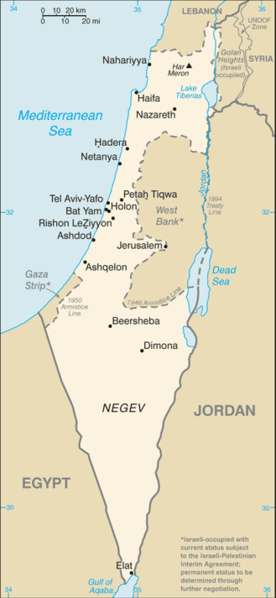
| atual | 07h25min de 21 de junho de 2007 |  | 329 × 713 (27 kB) | Hoshie | Updated map of Israel from the CIA World Factbook, 14 June 07 rev. Src: https://www.cia.gov/library/publications/the-world-factbook/maps/is-map.gif |
| 14h27min de 16 de junho de 2005 |  | 330 × 715 (24 kB) | Csörföly D | Category:Maps of Israel {{PD-USGov-CIA-PD}} |
Utilização local do ficheiro
A seguinte página usa este ficheiro:
Utilização global do ficheiro
As seguintes wikis usam este ficheiro:
- ar.wiki.x.io
- bg.wiki.x.io
- bn.wiki.x.io
- bs.wiki.x.io
- ca.wiki.x.io
- de.wiki.x.io
- en.wiki.x.io
- History of Israel
- Israeli Declaration of Independence
- Israeli settlement
- Zionism
- Israeli–Palestinian conflict
- Law of Return
- Demographic history of Palestine (region)
- User talk:Theblackbay
- Israel
- Chronology of Aliyah in modern times
- History of Palestine
- Timeline of the name Palestine
- Template:Zionism and the Land of Israel
- Land of Israel
- Module:Location map/data/Israel/doc
- Module:Location map/data/Israel
- User:প্রলয়স্রোত/sandbox
- List of journalists killed during the Israeli–Palestinian conflict
- Israeli war crimes
- Palestinian war crimes
- en.wikinews.org
- es.wiki.x.io
- eu.wiki.x.io
- fi.wiki.x.io
- fi.wikivoyage.org
- fr.wiki.x.io
- fr.wikinews.org
- hif.wiki.x.io
- hi.wiki.x.io
- hr.wiki.x.io
- hy.wiki.x.io
- ilo.wiki.x.io
- it.wikinews.org
Ver mais utilizações globais deste ficheiro.
