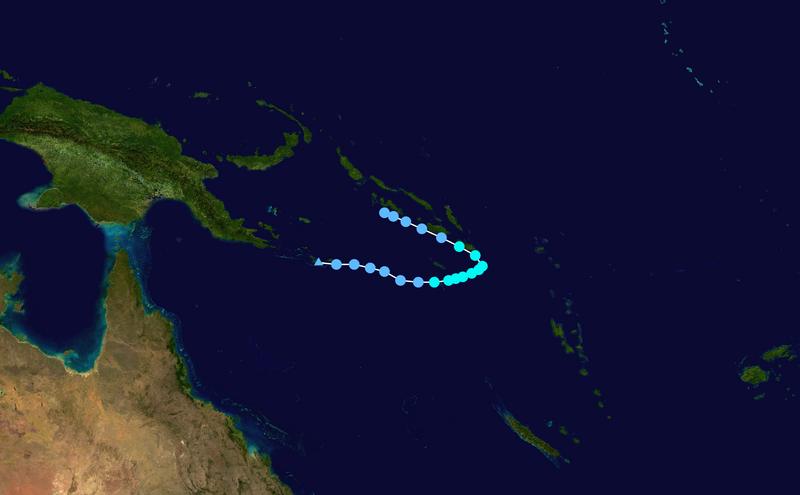
Ficheiro:Liua 2018 track.png

Dimensões desta antevisão: 800 × 495 píxeis. Outras resoluções: 320 × 198 píxeis | 640 × 396 píxeis | 1 024 × 633 píxeis | 1 280 × 791 píxeis | 2 700 × 1 669 píxeis.
Imagem numa resolução maior (2 700 × 1 669 píxeis, tamanho: 1,58 MB, tipo MIME: image/png)
Histórico do ficheiro
Clique uma data e hora para ver o ficheiro tal como ele se encontrava nessa altura.
| Data e hora | Miniatura | Dimensões | Utilizador | Comentário | |
|---|---|---|---|---|---|
| atual | 13h58min de 7 de janeiro de 2021 |  | 2 700 × 1 669 (1,58 MB) | Meow | Strict 6-hour track |
| 11h42min de 7 de janeiro de 2021 |  | 2 700 × 1 669 (1,62 MB) | AveryTheComrade | BT update | |
| 13h46min de 10 de novembro de 2018 |  | 2 700 × 1 669 (1,58 MB) | Meow | 10-01 06Z | |
| 16h16min de 29 de setembro de 2018 |  | 1 024 × 633 (333 kB) | Keith Edkins | 29/1200z | |
| 12h25min de 28 de setembro de 2018 |  | 1 024 × 633 (327 kB) | Keith Edkins | 28/0600z | |
| 21h12min de 27 de setembro de 2018 |  | 1 024 × 633 (325 kB) | Keith Edkins | 27/1200z | |
| 18h19min de 26 de setembro de 2018 |  | 1 024 × 633 (326 kB) | Keith Edkins | {{Information |Description={{en|Track map of Tropical Depression 01F of the 2018–19 South Pacific cyclone season. The points show the location of the storm at 6-hour intervals. The colour represents the storm's maximum sustained wind speeds as classified in the Saffir-Simpson Hurricane Scale (see below), and the shape of the data points represent the natu... |
Utilização local do ficheiro
As seguintes 2 páginas usam este ficheiro:
Utilização global do ficheiro
As seguintes wikis usam este ficheiro:
- ceb.wiki.x.io
- de.wiki.x.io
- en.wiki.x.io
- ko.wiki.x.io
- th.wiki.x.io
- vi.wiki.x.io
- zh.wiki.x.io